The WIM 'Winter Warmer'

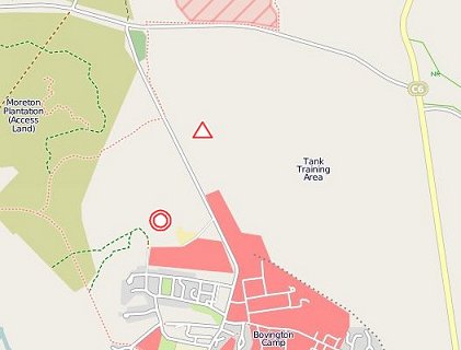
The OpenStreetMap image above links to Google Maps where you can see the terrain in satellite view.
The days are long gone when the envelope containing the results for an event used to drop through the letter box two or more weeks later when the actual courses had become a vague memory. Nowadays, particularly with Dick aiming to maintain his reputation for quick postings, results are on the web page almost before the competitor has returned home. One side effect of this is that the Planner's Comments are rarely seen. He cannot match this timetable as he is still busy clearing up on site. So although those of you who took part already know how you got on, I thought it might be interesting to set out some of the background to the event.
Wimborne as a club tries to give a wide range of people experience in planning events so many of you will know that one of the basic principles for the planner is to allow yourself plenty of time. When I was asked at the beginning of November to plan this event in early February I accepted and thought that gives me plenty of time. Land access was being obtained and though agreed in principle the necessary confirming letter from the Army’s Estates Division was slow in coming. Their view was “What’s the rush? It is not until February.” Still without formal confirmation, by mid November I felt that I had to meet with the Bovington Training Area Access Officer to see when it was possible to visit the area. He was helpful apart from the fact that because of increased training pressures I could not get onto the area until the Christmas stand-down on 16 December. Checking on this the week before, the situation had changed. The area was being used the week before Christmas for special trials. The only availability was a Friday afternoon on Bovington West at a time of year when daylight was at its shortest. Eventually I got onto Wool Heath for the first and only time on 27, 28 and 30 December.
So basically this left five weeks to plan the courses in relation to the terrain, visit the control sites and tag them, make any major map corrections, for the controller to visit the area and for us to agree any discrepancies and for the maps to be prepared for printing. Not an ideal scenario and completely contrary to the advice to allow plenty of time.
Inevitably there had to be a considerable amount of pre-visit arm chair planning. Luckily, prior to the Caddihoe about six years ago, I had updated the map for Bovington West and, with John Warren, that for Wool Heath. I had also subsequently run on both of them so had a reasonable knowledge of the area although not of any changes which might have taken place subsequently. Any nasty surprises had to wait for my visit.
Turning to the planning itself I had to start with various fixed factors. Firstly the event was to be primarily on Wool Heath and the car parking was to be on the hard surfaced area belonging to DSG to the south of Bovington West. The only crossing point between the two areas was the one I used approximately 1 kilometre north of the car park. To avoid further walking this meant a start fairly close to the crossing. However this led into areas which were totally unsuitable for White and Yellow courses.
Personally I don’t mind a walk to the Start but like to finish fairly close to Assembly. So the obvious solution was two starts – the senior one on Wool Heath and the Junior one fairly near the car park with a common finish again close to the car park. For the Juniors Bovington West had the advantage of a fairly dense path network. For the Seniors it offered some short legs in different terrain to Wool Heath. I had hoped to include the Orange course on Bovington West. This proved impossible as there was just not sufficient area. The northern triangle was off limits for nature conservation reasons and the Army ”recreational area” to the south is now cut off by a brand new un-crossable barbed wire fence. So the Orange started on Wool Heath with some legs which were at the limits of acceptability.
Looking at the road crossing I wanted to separate the two flows of people, those walking to the start and the runners returning to Bovington West. This dictated that the start should be to the south and that the courses approach the crossing from the north. This gave courses which basically made an anticlockwise circuit of Wool Heath. Furthermore the main circuit road offered easy route choice and a major catching feature. Unless the course was sufficiently long to get right into the forested areas on the east side of the map, I wanted to try and contain the shorter courses within the road. Unfortunately a key control site was a bit dodgy so the gully beyond the road (150) had to be used as there were not sufficient access opportunities to the area to identify a better alternative. This gave a road run on the Green and Short Green courses which I had hoped to avoid. The longer courses – Short Blue upwards- were of sufficient length to reach that eastern forested areas to use a bit of more traditional terrain.
Given the constraints of the area and the time available to plan the courses I hope that for most people the courses were enjoyable and offered sufficient challenge in orienteering terms despite the conditions underfoot.
It is interesting to look at Routegadget and see the alternative routes that as a planner you have overlooked. For example Geoff Ellis, winner of Brown, ran back through the start to reach 1 although it does not appear to have been the quickest route. On Short Brown Gavin Clegg and Ian Moran both made leg 7 -8 into a massive in and out. It is difficult to foresee every option.
Finally the event could not have proceeded so smoothly without the input of Ian Sayer, the controller from Wessex, who accepted the abbreviated timescale; of Trevor Bridle with his efficient organisation; of Judith who accompanied me on most of my visits to the area and gave valuable comments on the draft course; and of all the club members who helped in various capacities on the day. Thanks to you all.
David Bland - Planner
Click to browse the Final Results and Routegadget. The Club League has been updated with Winter Warmer scores.